Boundary Survey Cost in NZ: What Drives the Price and What You Actually Get
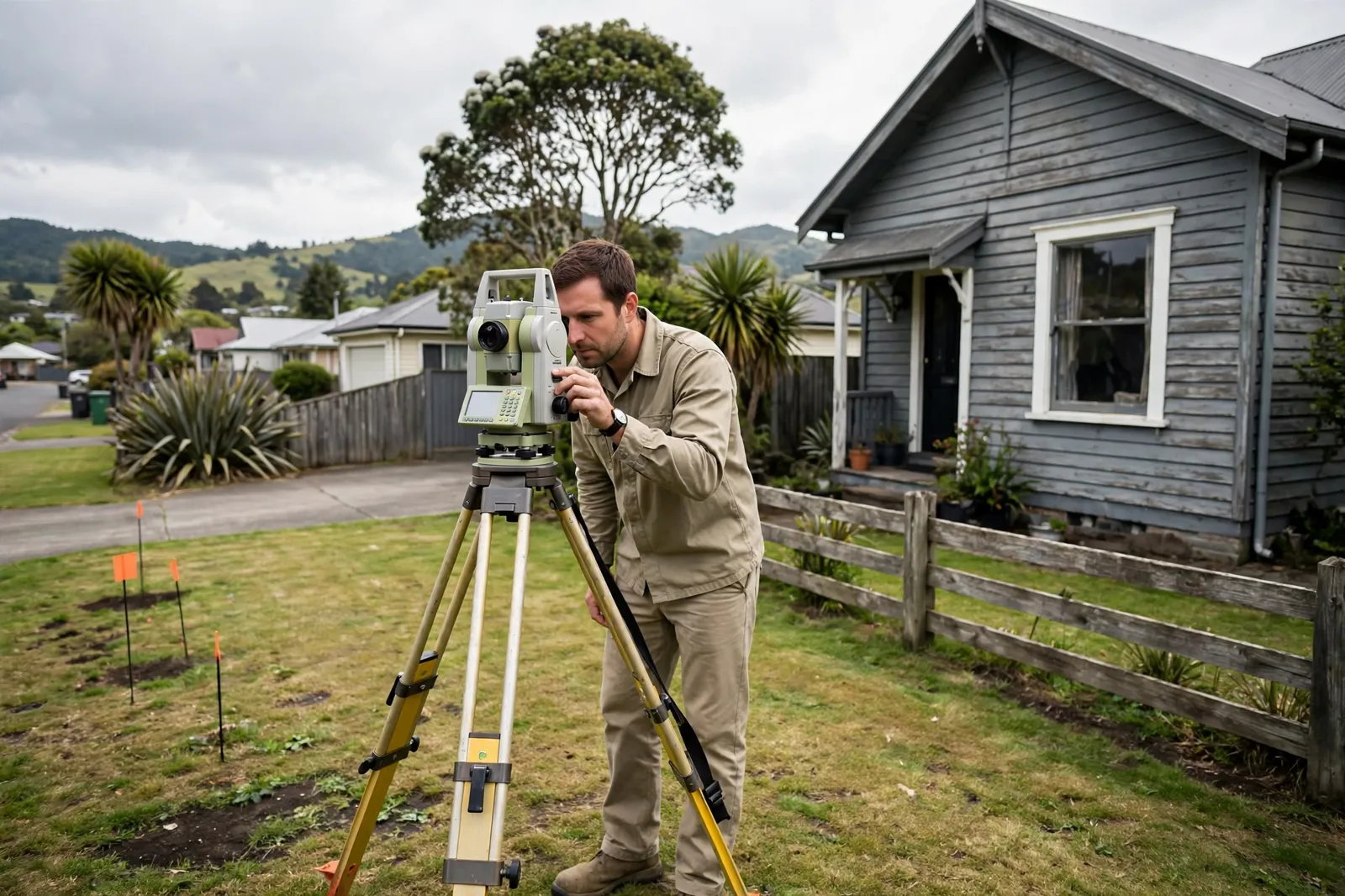
Most homeowners first think about a boundary survey at an awkward moment. The fence builder is booked, the neighbour has queried the line, or a builder wants certainty before concrete is poured close to the edge of the section. The next question is usually the price, and it is the one question the internet answers badly. Search results are full of confident dollar ranges, yet almost none of them come from anyone who actually does the work in New Zealand.
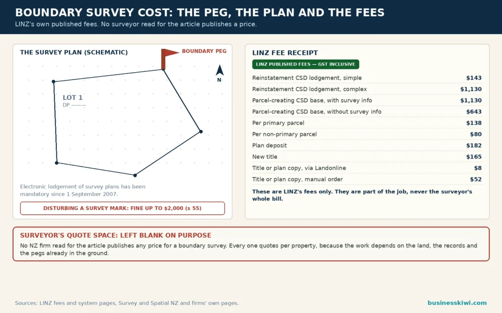
Here is the honest position, stated up front. New Zealand surveying firms almost never publish a price for a boundary survey. The firms whose own pages were read in full for this article, including Cook Costello, Thornley and Associates, and Eliot Sinclair, all price the job after looking at the property, because the work involved varies so much from one section to the next. What can be stated exactly is the official part of the bill: the fees Land Information New Zealand (LINZ) charges to lodge the survey dataset your surveyor prepares. Those fees are published, they are fixed, and for a boundary reinstatement they range from $143 to $1,130 including GST depending on complexity. Everything else in the quote is the surveyor’s own time, and this article explains what that time is spent on, what makes it grow, and how to compare quotes on equal terms.
What a boundary survey actually is
A boundary survey establishes where your legal boundaries sit on the ground. In New Zealand the legal position of a boundary does not come from the fence, the hedge, or the edge of the driveway. It comes from the official survey record held by LINZ: the cadastre, the national set of survey records that documents the boundaries of freehold, leasehold, Māori and Crown land. A boundary survey is the process of taking that record, testing it against the physical evidence still surviving on and around your property, and marking the boundary corners on the ground, usually with pegs.
Firms use a few names for this work, and the names matter because they describe different levels of job. A boundary reinstatement, also called a redefinition survey, re-establishes an existing legal boundary and replaces any pegs that are missing or disturbed. Where new boundary marks are placed, a reinstatement plan or dataset is lodged with LINZ so the work becomes part of the public survey record. A boundary location survey is lighter: it locates the position of an existing boundary so you can plan fencing, design work or building near the line, without legally redefining anything. Cook Costello draws exactly this distinction on its land surveying page: a location survey may suit planning and fencing decisions, while a cadastral survey is required where the boundary is being legally defined, redefined or used to create a new title.
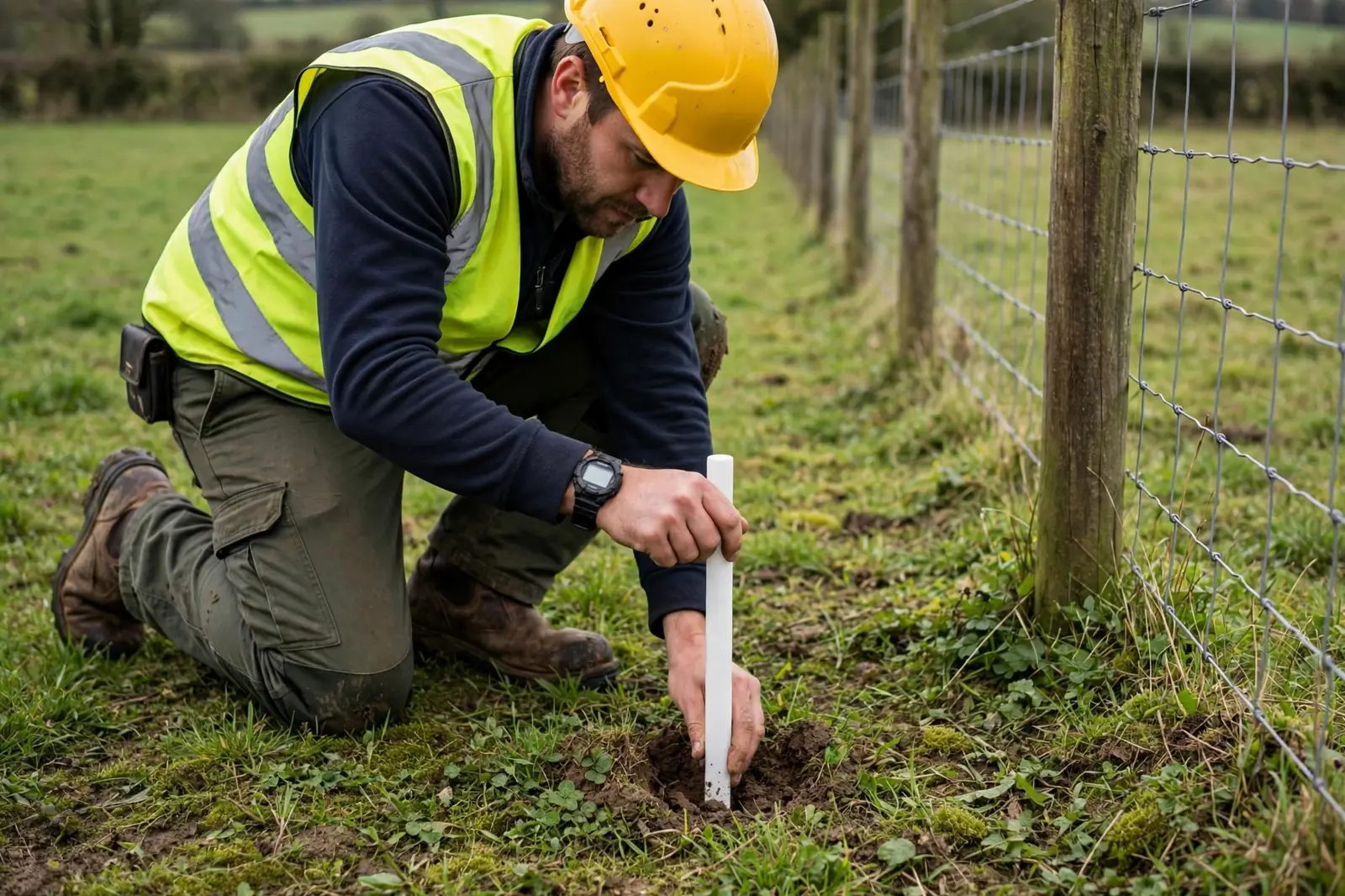
One point surprises many owners. The pegs themselves are not the boundary. They are evidence of it. Eliot Sinclair’s guide to boundary pegs explains that pegs sit at the corners where a boundary changes direction, that they are usually square wooden or plastic pegs painted white and set at ground level, and that surveyors also rely on less visible marks: metal spikes, rods and discs, sometimes buried or set under covers. The recorded positions of those marks sit in LINZ’s Landonline database. If every peg on your street vanished tomorrow, the boundaries would still exist in the record. The surveyor’s job is to rebuild the connection between the record and the ground, and that rebuilding is what you are paying for.
When you are likely to need one
Putting up a fence. Fences are the most common trigger. A fence built on the wrong line creates problems out of proportion to the strip of land involved, because moving it later means paying for the work twice and having an uncomfortable conversation in between. Thornley and Associates make the point bluntly on their boundary page: fences are often built along the easiest contour rather than the correct boundary, so it pays to check before the postholes are dug. If you are buying fence posts and rails for a long boundary, the survey is cheap insurance relative to the cost of the fence itself.
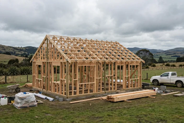
Building or extending near a boundary. A garage, sleepout or extension placed even slightly over the line is a serious problem, and builders know it. Cook Costello note that buildings have ended up across legal boundaries because pegs were missing or in the wrong place. A survey before design work fixes the line so setbacks can be measured from the real boundary, not an assumed one.
A disagreement with a neighbour. Where two owners disagree about where the line runs, opinion counts for nothing and the survey record counts for everything. A boundary survey re-establishes the legal boundary from the official records and the surviving evidence, then marks it on the ground. Cook Costello note that because the work is carried out by or under a licensed cadastral surveyor, it provides an independent factual basis for the discussion. A survey settles where the boundary is; questions about rights, encroachments or what should happen next can still need legal advice on top.
Buying or selling. Sellers get asked about boundaries, and buyers of lifestyle blocks or older properties in particular want to know how much land they are actually getting. A survey gives a precise answer rather than an assumption based on the fenceline. It is also common where co-owners hold land as tenants in common and are formalising who uses which part of a property, a situation where the recorded boundary and the day-to-day use of the land do not always line up.
Subdivision, treated as a separate job. Defining boundaries is also the first step in subdividing, but a subdivision is not a bigger boundary survey. It is a different and much larger process involving scheme plans, resource consent, council certification, services, the cadastral survey itself, and new titles at the end. Prices quoted for subdivision work, or for jobs like converting a cross lease to fee simple titles, tell you nothing useful about the price of reinstating the pegs on an existing section, and this article does not use them for that purpose.
Who is allowed to do the work
This part is fixed by law, and it is one reason prices do not behave like ordinary trades pricing. LINZ states that cadastral surveys can only be undertaken by a licensed cadastral surveyor, or by someone working under the direction of one. Licences are issued annually by the Cadastral Surveyors Licensing Board, and renewal depends on the surveyor maintaining competency. Only a licensed cadastral surveyor can legally place boundary pegs, certify the survey, and lodge the cadastral survey dataset with LINZ through Landonline, where electronic lodgement has been mandatory since 1 September 2007.
That has two practical consequences for cost. First, you are buying the time of a small, licensed profession, and there is no unlicensed budget tier for legal boundary work. Anyone can measure your section with a tape and a phone app; nobody except a licensed cadastral surveyor can produce a boundary definition that stands in the official record. Second, the surveyor carries professional responsibility for the result. If a dataset contains an error affecting a title, the regulatory framework allows the Surveyor-General to require the responsible surveyor to correct it. That accountability is built into the fee.
Finding a surveyor is straightforward. Survey and Spatial New Zealand, the professional association for the survey and spatial sector, runs a find-a-surveyor service on its website. LINZ’s survey system pages explain how the cadastre and licensing fit together, and most local firms will tell you on their own websites whether licensed cadastral surveyors sit within their team, as Cook Costello does.
What the job involves, step by step
Understanding the steps makes the quotes easier to read, because each step is a cost driver when it goes badly.
The desktop work comes first. Before anyone visits your property, the surveyor pulls the official records: your record of title, the cadastral survey plan behind it, and the plans for surrounding properties. LINZ explains that cadastral survey plans show a property’s legal boundaries, area and dimensions, and that plans come in three main families: deposited plans, survey office plans and Māori land plans. Some plans date back to around 1850. Very old plans can be hard to work with: dimensions may be recorded in links rather than metres, as Eliot Sinclair note in their pegs guide, and the network of marks the original survey relied on may have thinned out over a century and a half. The surveyor studies this material and plans the fieldwork, a stage Cook Costello describe as their desktop review and survey planning step.
Then the fieldwork. The surveyor visits the site to hunt for the original evidence: surviving pegs, reference marks, and marks on neighbouring parcels that fix the framework your boundary hangs off. This search is the heart of the job. Finding two or three solid original marks near your corners can confirm a boundary quickly. Finding none means the surveyor must work outward to more distant reliable marks and reconstruct the position, checking each piece of evidence against the record. The surveyor works through the official record, weighs each piece of surviving evidence, and determines the correct position from it. It is detective work with a total station, and the hours it takes depend almost entirely on what survives.
Marking the boundary. Once the position is determined, the surveyor places or replaces the pegs and records exactly what was done. Where original pegs are found undisturbed and proven, they stay. Where they are missing or disturbed, new marks go in at the correct positions.
The plan and the lodgement. The results are compiled into a cadastral survey dataset, certified by the licensed cadastral surveyor and lodged with LINZ through Landonline. LINZ checks and integrates the dataset into the cadastre, so your reinstatement becomes part of the record the next surveyor will rely on. This is the step that attracts the LINZ fees covered in the next section. For a pure location survey with no legal redefinition, this lodgement step may not apply at all, which is one reason location surveys cost less.
What you receive. Expect a plan showing your boundaries and the marks placed or found, a survey report explaining the evidence and any problems encountered, and pegs on the ground you can work from. If the survey uncovers something awkward, such as a fence or building sitting over the line, the report documents it. Dealing with it is a separate matter, but you will at least be dealing with facts.
What you pay for: the honest answer on price
No surveyed New Zealand firm publishes a boundary survey price list. Cook Costello answer their own cost question by saying there is no single price that applies to every property, and that they scope each job and provide a fee estimate before work begins. Thornley and Associates say the same in different words: the cost varies with the type of survey, the size of the property and the age of the underlying survey data, and they can provide an estimate at the start of a project. Eliot Sinclair, whose pegs guide answers the cost question directly, say costs vary with the size and location of the property and the complexity and age of the underlying data, and direct readers to contact the firm for an accurate estimate.
Read those three answers together and the pattern is clear. The price is not being hidden; it genuinely cannot be fixed in advance, because the surveyor cannot know until the records are checked how much evidence survives on your street. Any website that quotes you a confident typical cost for a boundary survey in New Zealand, without naming a firm that will honour it, is guessing. This article will not guess. Instead, the next two sections give you the figures that do exist, and the factors that move a real quote up or down.
The LINZ fees inside the quote
The one part of the bill set by someone other than the surveyor is the LINZ lodgement fee, and LINZ publishes it in full. All LINZ fees below are GST inclusive, as LINZ states on its survey and title fees page, and they are charged to the surveying firm’s Landonline account, which is why they usually appear inside your quote rather than as a separate payment you make yourself.
For a boundary reinstatement dataset, LINZ charges one of two fees:
- $143 for a simple boundary reinstatement.
- $1,130 for a complex boundary reinstatement.
That spread, from $143 to $1,130, is itself a lesson in how this work prices. LINZ’s own fee structure recognises that reinstating a boundary can be a small, tidy dataset or a complex one, and the classification reflects the amount of survey information and checking involved. When a surveyor explains that your job has tipped into complex territory, the LINZ fee alone may account for nearly $1,000 of the difference.
For comparison, the surrounding fees on the same LINZ schedule show where reinstatement sits in the system. A dataset that creates new parcels, as a subdivision does, carries a base fee of $1,130 where it includes survey information, or $643 where it does not, plus $138 for each primary parcel created and $80 for each non-primary parcel such as an easement. Depositing the plan costs a further $182, and each new title issued costs $165. At the other end of the scale, a dataset that simply provides survey information, placing no boundary mark and creating no parcel, carries no lodgement fee at all, and re-lodging a dataset after LINZ requisitions it is also free.
One more figure is useful if you want to do your own homework before ringing anyone. Copies of your record of title and your cadastral survey plan, title sheet or survey sheet, cost $8 each through Landonline, or $52 each through the manual service. Your surveyor will obtain these as part of the job, but having the title plan in hand makes the first conversation, and the quote, more precise.
What drives the price up or down
The age and quality of the underlying survey. This is the driver every firm names first. A modern urban section created by a recent deposited plan, surrounded by other recent surveys, sits inside a dense web of reliable marks and data. A section created by a survey from the 1880s or early 1900s may depend on a handful of old marks, some of which will have been destroyed by roadworks, fences and landscaping over the decades. The older and thinner the record, the longer the reconstruction takes. Thornley and Associates flag the age of the underlying and surrounding survey data specifically; Eliot Sinclair make the same point about rural and older areas needing extensive fieldwork where a simple urban job may only require locating existing pegs.
Whether the original marks survive. Closely related, and just as powerful. If the surveyor finds your original corner pegs undisturbed, plus good reference marks nearby, the boundary can be confirmed efficiently. If the pegs are gone and the surrounding marks are gone too, the surveyor must expand the search, sometimes well beyond your street, and rebuild the position from whatever evidence remains. A garden makeover, a new driveway or a retaining wall built exactly where a peg sat can quietly add hours to a job years later.
Terrain and vegetation. Steep, bush-covered or overgrown sections slow everything down. Lines of sight for instruments disappear, access to corners becomes a physical job in itself, and marks hidden under decades of growth take longer to find. A flat, clear, fenced city section is at the other extreme.
The number of boundaries and pegs. A standard rectangular section has four corners. An irregular section, a back section with an access leg, or a rural block can have many more, and every corner is a position that must be evidenced and marked. More boundaries also mean more neighbouring parcels whose records must be reconciled with yours.
Whether a dataset must be lodged. If new boundary marks are placed as part of a legal redefinition, a dataset goes to LINZ and the lodgement fee applies, $143 or $1,130 depending on complexity. If you only need to know where the line runs for a fence and the firm’s advice is that a location survey suffices, there may be no dataset, no LINZ fee, and less certification work. This is the single most useful question to ask when comparing two quotes that look far apart: are they pricing the same level of survey?
Conflict in the evidence. Occasionally the records and the ground disagree: an old survey was inaccurate, a peg was placed wrongly generations ago, or fences have drifted. Resolving conflict properly takes senior time, because the surveyor must weigh the evidence and reach a defensible position rather than a convenient one. Jobs with conflict are the ones that most often move beyond the original estimate, and a good firm will warn you early if yours looks like one.
Urgency and extras. A survey needed against a construction deadline, or bundled with extras such as setting out a building platform or certifying a building’s position relative to the boundary, adds scope. None of that is unreasonable; it just needs to be in the written scope so the price means something.
Getting quotes you can actually compare
Because there is no standard price, the quality of your quote process does the work that a price list would do elsewhere. A few practical steps, drawn from how the firms themselves describe their process:
- Ask at least two or three firms, and confirm each one has a licensed cadastral surveyor who will certify the work. Cook Costello make a point of stating that capability sits within their team; you want the same confirmation in writing from anyone you use.
- Give every firm the same information: the address, the record of title if you have it, which boundaries concern you, and what the survey is for. Quotes given on different briefs cannot be compared.
- Ask each firm to state the level of survey being quoted: location only, or a redefinition with pegs placed and a dataset lodged with LINZ. Then ask whether the LINZ lodgement fee is included, and at which level, simple or complex.
- Ask what could change the price. The honest answer will name the same drivers covered above: missing marks, old data, conflict in the evidence. A firm that explains its assumptions in writing is giving you something you can hold it to.
- Ask what you will receive at the end: the plan, the report, the pegs, and confirmation of lodgement where applicable.
- Get the final quote or estimate in writing before work starts. Both Cook Costello and Thornley and Associates describe providing a scope and estimate at the start of a project as their normal practice, so a written estimate is a reasonable thing to expect, not a favour.
If the quotes come back far apart, the gap usually sits in the level of survey or in different assumptions about the surviving evidence, not in one firm simply being expensive. Ask the cheaper firm what it has assumed, and ask the dearer firm what it has allowed for. The answers will tell you which quote is actually safer.
Once the pegs are in, look after them
A final cost point that owners rarely hear about. Survey marks are protected by law because the whole system depends on them. Under section 55 of the Cadastral Survey Act 2002, knowingly taking, destroying or altering the position of a survey mark is an offence, with a fine of up to $2,000, and the person responsible can also be liable for the cost of restoring the mark. Eliot Sinclair note that in practice most damage is unintentional: pegs get disturbed during construction, drainage work and fence installation. Their advice is to involve a surveyor before siteworks that could affect a mark, rather than after. If you have just paid to have your boundaries reinstated, tell your fencer, drainlayer and landscaper where the pegs are, and do not let anyone pull one out and put it back roughly where it was. A replaced peg is only worth anything if a licensed cadastral surveyor placed it.
Frequently asked questions
How much does a boundary survey cost in NZ?
There is no published standard price, and the surveying firms whose pages were read for this article do not publish one. Each firm quotes after checking your property’s records, because the work depends on the age of the underlying survey and how much original evidence survives. The fixed part of the bill is the LINZ lodgement fee for the dataset: $143 including GST for a simple boundary reinstatement, or $1,130 including GST for a complex one. The rest is the surveyor’s time, so get written quotes from two or three firms on the same brief.
Can I find and mark my own boundary to save money?
You can look for your pegs, and your title plan will help: it shows the dimensions of each boundary, and copies cost $8 through Landonline. What you cannot do is legally define the boundary or place boundary pegs yourself. LINZ states that cadastral surveys can only be undertaken by a licensed cadastral surveyor or someone under their direction, and only a licensed cadastral surveyor can legally place boundary pegs. A line you mark yourself carries no weight in the official record or in a dispute.
What is the difference between a boundary location survey and a redefinition survey?
A location survey finds and shows you where an existing boundary sits, which suits planning, fencing and early design decisions. A redefinition or reinstatement survey legally re-establishes the boundary, replaces missing pegs, and results in a dataset lodged with LINZ so the work enters the public survey record. The redefinition is the fuller and more expensive job, and part of the difference is the LINZ lodgement fee of $143 or $1,130 including GST, depending on whether LINZ classifies it as simple or complex.
Why do quotes for the same property vary so much?
Usually because the firms are pricing different levels of survey, or making different assumptions about the evidence. One quote may assume your original pegs survive and a simple dataset will do. Another may allow for the pegs being gone, older records, and a complex lodgement. Ask each firm what level of survey it has priced, whether the LINZ fee is included and at which level, and what would cause the price to change. The answers make the quotes comparable.
My fence is not on the boundary. Does the survey move it?
No. A survey establishes where the legal boundary is and marks it; it does not move fences or settle what happens about an encroachment. Fences often sit off the true line, because they were built along the easiest contour or by eye. Once you know the facts, you and your neighbour can decide what to do, and questions about rights and remedies can need legal advice. Note that the cost of the survey itself is separate from fencing costs, which adjoining occupiers generally share in equal proportions for an adequate fence under the Fencing Act 1978.
Is subdivision just a bigger boundary survey?
No. A boundary reinstatement deals with an existing parcel. Subdivision creates new parcels, and adds scheme plans, resource consent, council certification, services and new titles. The LINZ fees alone show the difference: a subdivision dataset carries a base fee of $1,130 including GST where it includes survey information, plus $138 per primary parcel, $182 for plan deposit and $165 for each new title, before the surveyor’s substantially larger workload. Prices quoted for subdivision or cross-lease conversion work should never be used to estimate a simple reinstatement.
What happens if my pegs have been removed or destroyed?
A licensed cadastral surveyor can reinstate them, which is exactly what a redefinition survey does: the position is rebuilt from the official record and surviving evidence, and new marks are placed. Do not replace a peg yourself, and do not let a contractor do it. Under section 55 of the Cadastral Survey Act 2002 it is an offence to knowingly take, destroy or alter the position of a survey mark, with a fine of up to $2,000, and placing a peg that is not a properly placed cadastral mark can mislead everyone who relies on it later.
How do I find a licensed cadastral surveyor?
Survey and Spatial New Zealand, the professional association for the survey and spatial sector, runs a find-a-surveyor service on its website. Local firms also state on their own websites whether licensed cadastral surveyors are on their team. Whoever you approach, confirm before you accept a quote that a licensed cadastral surveyor will direct and certify the work, because that certification is what makes the result count in the official record.
Sources
- Land Information New Zealand (LINZ), Survey and title fees: https://www.linz.govt.nz/products-services/landonline/landonline-fees-and-charges/survey-and-title-fees
- Land Information New Zealand (LINZ), The survey system: https://www.linz.govt.nz/node/6190
- Land Information New Zealand (LINZ), Cadastral survey plan: https://www.linz.govt.nz/node/6242
- Survey and Spatial New Zealand, Home page and find a surveyor service: https://www.surveyspatialnz.org/
- Cook Costello, Land Surveying NZ: https://www.coco.co.nz/land-surveying
- Thornley and Associates, Boundary Surveys and Boundary Peg Placement: https://thornley.co.nz/services/boundary-redefinition-survey/
- Eliot Sinclair, Everything You Need to Know About Boundary Pegs in New Zealand: https://www.eliotsinclair.co.nz/insights/everything-you-need-to-know-about-boundary-pegs-in-new-zealand
This article is general information about boundary surveys and their costs in New Zealand, based on the sources listed above as published when the article was written. It is not legal, surveying or financial advice, and it does not predict the price of any individual job. Survey costs depend on the property and the surviving survey evidence, so obtain written quotes from licensed cadastral surveyors for your own land before committing to work.